Map II: Lower Manhattan in Aboriginal Times — Bolton (1922)
Map II: Lower Manhattan in Aboriginal Times — Bolton (1922)
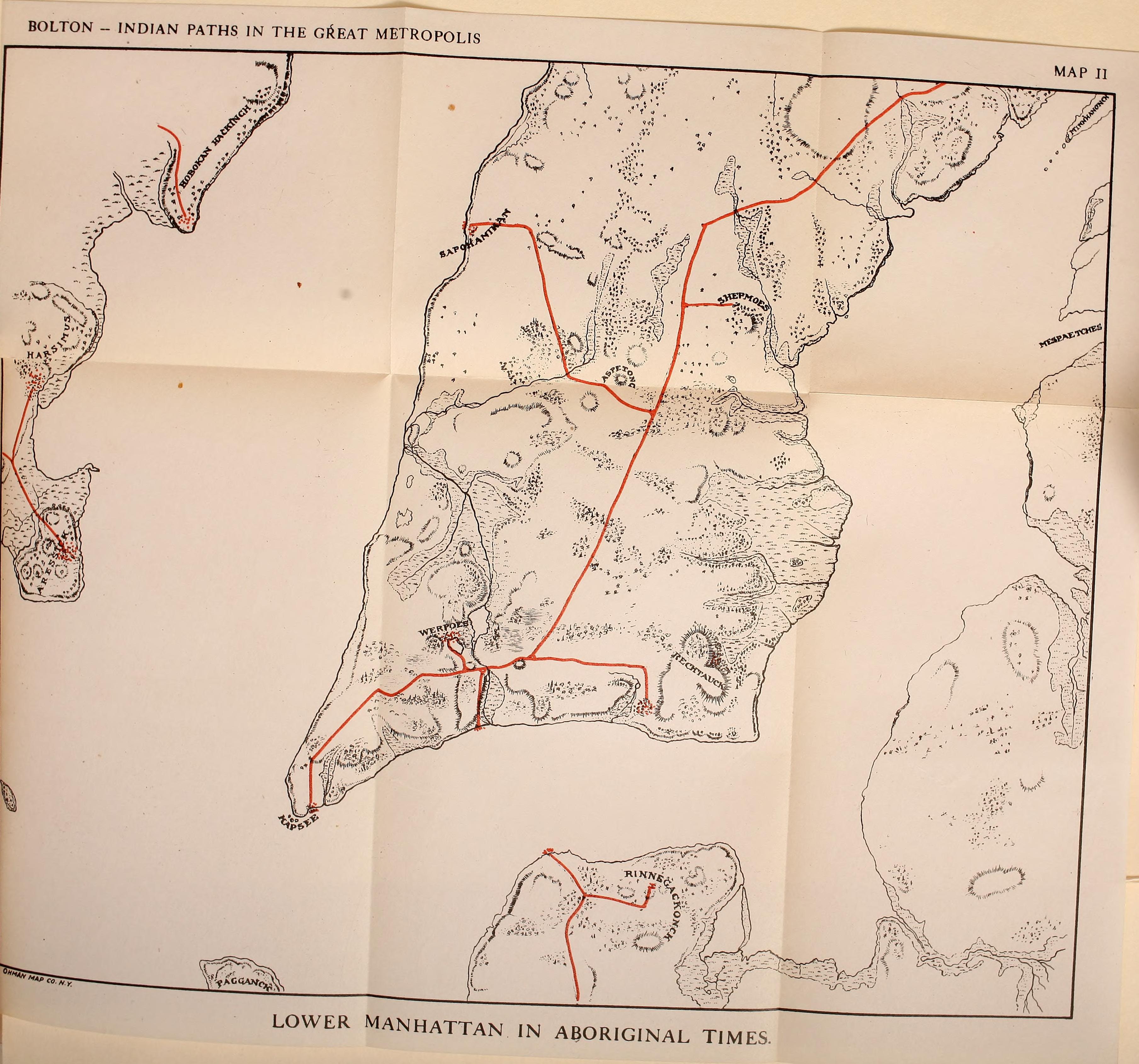
Fold-out map from Bolton’s Indian Paths showing Lower Manhattan as it appeared in aboriginal times, with indigenous trail routes marked in red. Shows Lenape place names including Sapokanican, Werpoes, Konaande Kongh, Kapsee, and Rinnegakonck. Includes parts of New Jersey (Harsimus) and western Long Island (Mespacetches). Published by Ohman Map Co., N.Y.
Date: 1922 Location: Lower Manhattan Type: map Subjects: map, indigenous trails, Lenape place names, Lower Manhattan Text visible in image: BOLTON - INDIAN PATHS IN THE GREAT METROPOLIS, MAP II, LOWER MANHATTAN IN ABORIGINAL TIMES
Source: Bolton, Indian Paths in the Great Metropolis (1922), Map II License: Public domain
— NOTE: This entry was generated from photo metadata using AI vision analysis and automated tools. Details may contain errors. Refer to the original source for authoritative information.