Hydrographic Map Showing Line of Croton Aqueduct (1846)
Hydrographic Map Showing Line of Croton Aqueduct (1846)
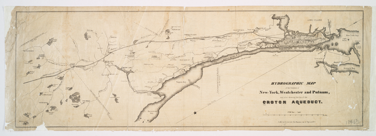
Detailed map from the NYPL Map Division showing the complete route of the Croton Aqueduct from the Croton Dam through Westchester County to Manhattan. Compiled under the direction of chief engineer John B. Jervis. Shows the relationship of the aqueduct to rivers, hills, and settlements along its 41-mile route.
Date: 1846 Type: map Subjects: Croton Aqueduct, rivers, hills, settlements, Westchester County, Manhattan Text visible in image: HYDROGRAPHIC MAP New York, Westchester and Putnam, CROTON AQUEDUCT.
Source: NYPL, Lionel Pincus and Princess Firyal Map Division License: Public domain
— NOTE: This entry was generated from photo metadata using AI vision analysis and automated tools. Details may contain errors. Refer to the original source for authoritative information.