Home /
Library of Congress, Geography and Map Division /
Passage
Country Between the North River and Croton River (1776)
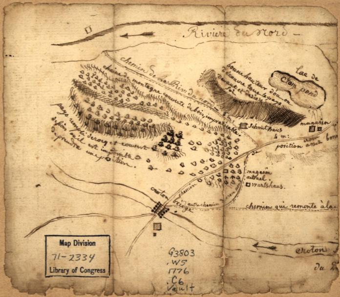
Country Between the North River and Croton River (1776)
French military manuscript map (pen and ink) from the American Revolution showing the terrain between the Hudson River and the Croton River. Includes military annotations. This area would become the route of the Croton Aqueduct sixty years later.
Date: 1776 Location: Westchester County, NY
Source: Library of Congress, Geography and Map Division License: Public domain
— NOTE: This entry was generated from photo metadata using AI vision analysis and automated tools. Details may contain errors. Refer to the original source for authoritative information.