Lloyd's Topographical Map of the Hudson River (1864)
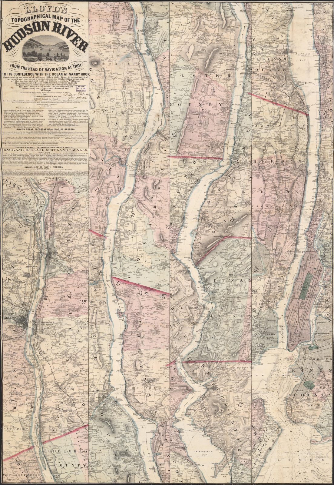
Lloyd's Topographical Map of the Hudson River (1864)
J.L. Lloyd's detailed map covering Troy to Sandy Hook, showing all buildings and householders' names within 4 miles of the river. Croton Point and the Croton River mouth are labeled with individual property owners.
Date: 1864 Location: Hudson River, NY (Troy to Sandy Hook) Type: map Subjects: Hudson River, map, topography, Croton Point, Croton River Text visible in image: Lloyd's Topographical Map of the Hudson River, From the Head of Navigation at Troy to its Confluence with the Ocean at Sandy Hook
Source: Library of Congress License: Public domain
— NOTE: This entry was generated from photo metadata using AI vision analysis and automated tools. Details may contain errors. Refer to the original source for authoritative information.