1867 Atlas - Mamaroneck, Westchester Co., NY
1867 Atlas - Mamaroneck, Westchester Co., NY
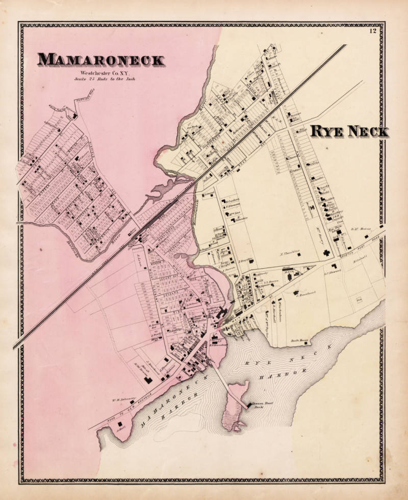
This is a map from the 1867 Atlas of Westchester County showing the area of Mamaroneck, Rye Neck, and surrounding regions. The map displays property lines, roads, and notable locations in the area.
Date: 1867 Location: Croton-on-Hudson, NY Type: map Subjects: map, Mamaroneck, Rye Neck, Westchester County Text visible in image: MAMARONECK, Westchester Co., NY, Scale 25 Rods to the Inch, RYE NECK
Source: Westchester County Archives Digital Collections (p17286coll1) License: Public domain
— NOTE: This entry was generated from photo metadata using AI vision analysis and automated tools. Details may contain errors. Refer to the original source for authoritative information.