Table of Air-Line Distances
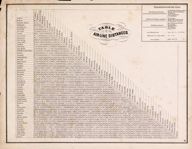
Table of Air-Line Distances
This image shows a table of air-line distances from various locations in and around Westchester County, New York. The table is presented in a vintage style with a decorative title and includes explanations for the atlas. The page is yellowed with age and has a few stains.
Date: 1867 Location: Town of Cortlandt, Westchester County, NY Type: engraving Subjects: map, table, distances Text visible in image: TABLE OF AIR-LINE DISTANCES. Explanations for this Atlas: ...
Source: Westchester County Archives Digital Collections (p17286coll1) License: Public domain
— NOTE: This entry was generated from photo metadata using AI vision analysis and automated tools. Details may contain errors. Refer to the original source for authoritative information.