Home /
Wikimedia Commons /
Passage
Sauthier Map — Province of New York (1778)
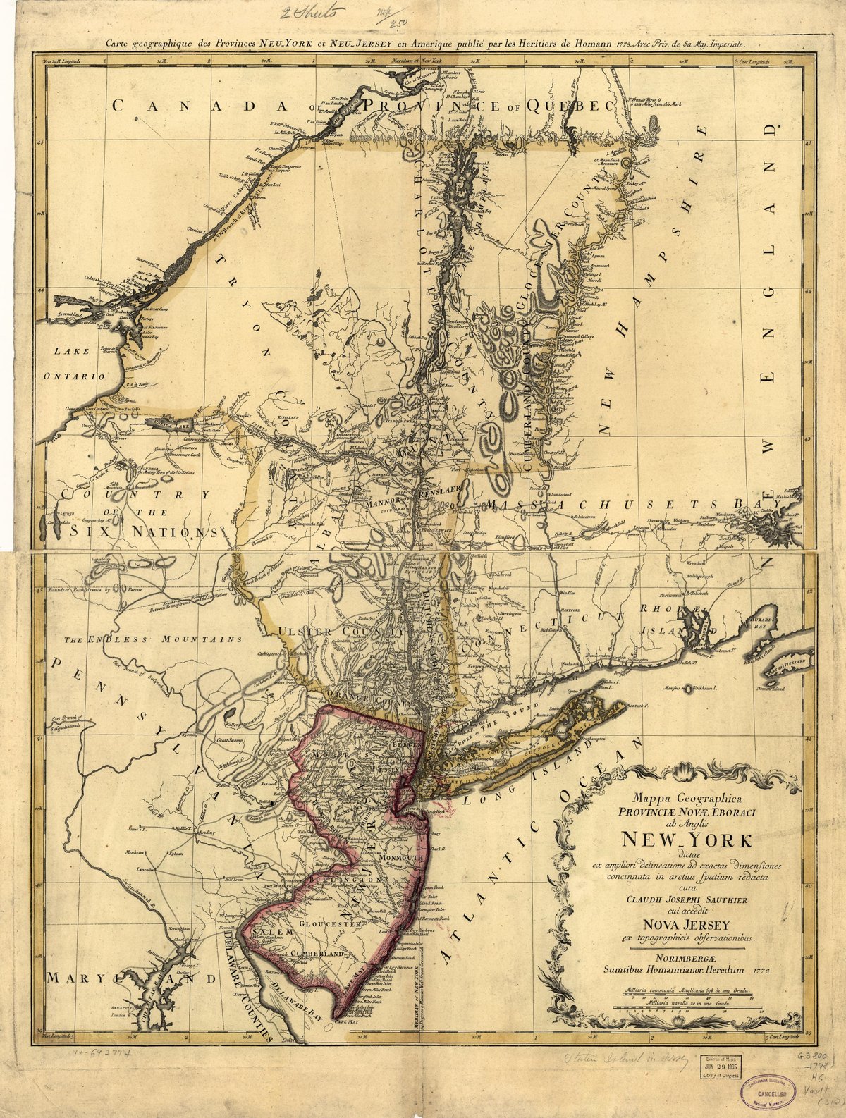
Sauthier Map — Province of New York (1778)
Claude Joseph Sauthier's detailed 1778 map of the Province of New York showing Westchester County, the Van Cortlandt and Philipse manors, and the Croton River area during the Revolution.
Date: 1778 Type: map Subjects: map, Province of New York, Westchester County, Croton River, New Jersey Text visible in image: Carte geographique des Provinces de New York et de New Jersey en Amerique... Mappa Geographica Provinciae Novae Eboraci... Nova Jersey
Source: Wikimedia Commons License: Public domain
— NOTE: This entry was generated from photo metadata using AI vision analysis and automated tools. Details may contain errors. Refer to the original source for authoritative information.