Home /
Royal Maritime Museum / Wikimedia Commons /
Passage
Visscher Map of New Netherland
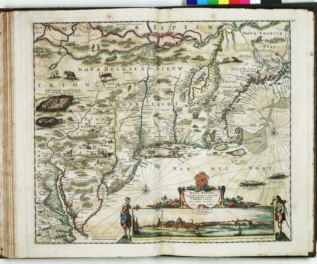
Visscher Map of New Netherland
Nicolaes Visscher map of New Netherland showing Dutch colonial settlements and Native American territories along the Hudson River.
Date: c. 1655-1685 Type: map Subjects: river, map, Native American territories, Dutch colonial settlements, ships, animals Text visible in image: Novi Belgii
Source: Royal Maritime Museum / Wikimedia Commons License: Public domain
— NOTE: This entry was generated from photo metadata using AI vision analysis and automated tools. Details may contain errors. Refer to the original source for authoritative information.