Home /
Wikimedia Commons /
Passage
Novi Belgii Map Detail — Allard/Ottens
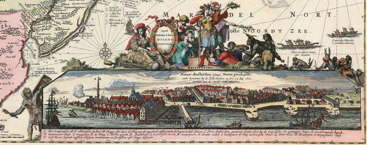
Novi Belgii Map Detail — Allard/Ottens
Detail from the Allard/Ottens map of New Belgium showing indigenous settlements along the Hudson River near present-day Croton.
Date: c. 1662
Source: Wikimedia Commons License: Public domain
— NOTE: This entry was generated from photo metadata using AI vision analysis and automated tools. Details may contain errors. Refer to the original source for authoritative information.