Mitchell Map of the Middle British Colonies (1755)
Mitchell Map of the Middle British Colonies (1755)
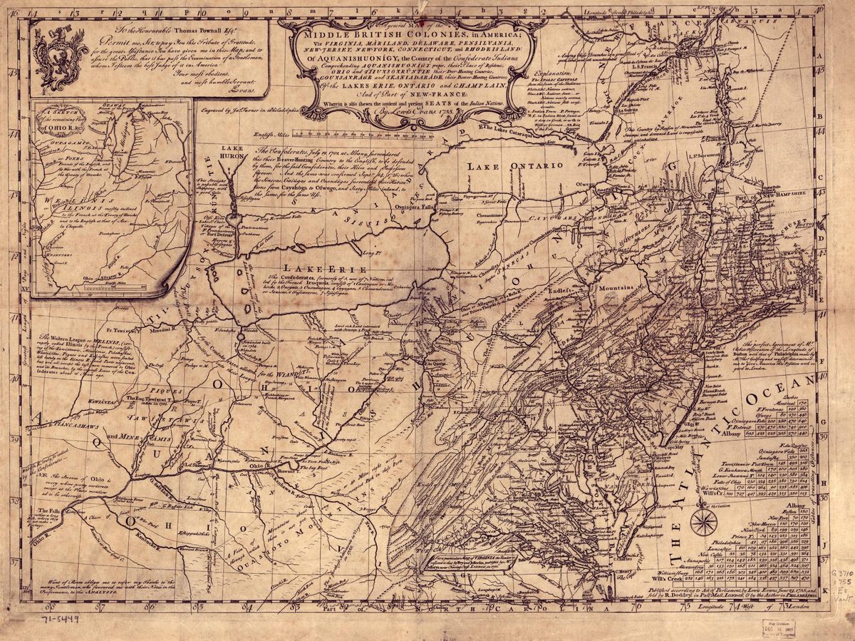
John Mitchell's 1755 map of the Middle British Colonies, showing Westchester County and the Hudson Valley during the colonial era.
Date: 1755 Location: Middle British Colonies Type: map Subjects: map, colonial era, Middle British Colonies, Native American territories, rivers, lakes, mountains Text visible in image: The map includes a title that reads 'Middle British Colonies, in America: viz. Virginia, Maryland, Delaware, Pennsylvania, New Jersey, New York, Connecticut & Rhode Island of Aquanishuonigy. The Country on the Lakes Erie, Ontario and Champlain, & Part of St. Art of New-France.'
Source: Library of Congress License: Public domain
— NOTE: This entry was generated from photo metadata using AI vision analysis and automated tools. Details may contain errors. Refer to the original source for authoritative information.